About the Program
We provide instructional, technical, and research support to the St. Lawrence University community in the use of geospatial software and technology.
We offer instruction and support relating to Geographic Information Systems, Remote Sensing, and Global Positioning Systems.
GIS Instruction and Support
The Library's GIS Program supports GIS across the curriculum with help for faculty, staff, and students. We provide one-on-one instruction, class instruction, technical support, and help with the use of GIS in research design. We are also able to identify spatial data sources for use in research or class projects.
The GIS staff is available Monday thru Friday 8:30 - 4:30 to instruct students and faculty in the use of GIS and GPS. Student GIS Technicians are available for technical support Sun – Thurs evenings in the GIS Lab. Contact Carol Cady, GIS/Map Specialist to find out how GIS can enhance your studies.
Services
The services we provide include:
- GIS Instruction
- GIS Project Planning
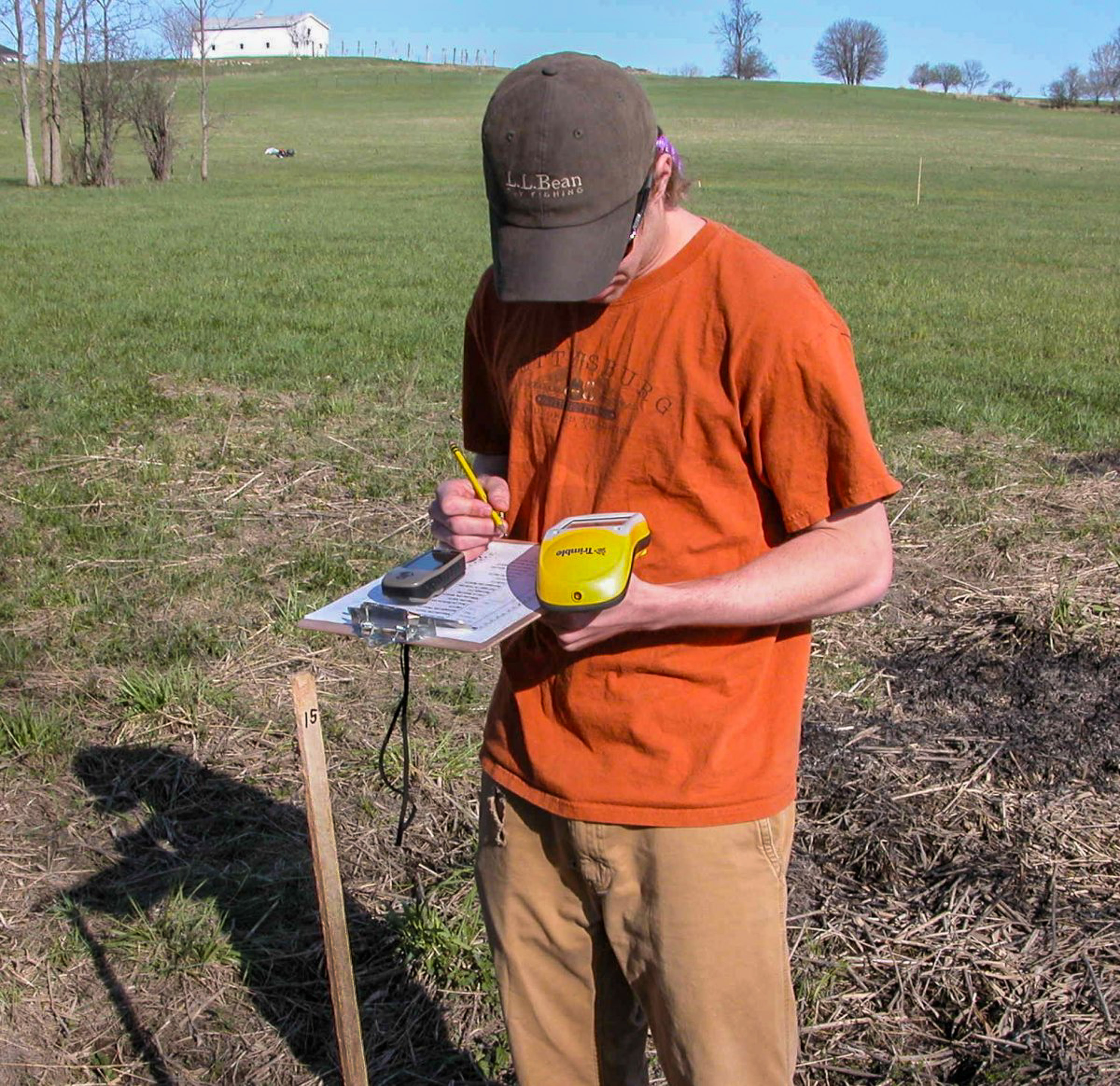
- GPS Training and Equipment Loan
- Data Acquisition
- Internet Map Hosting
Contact us with questions or for assistance with your project
Facilities
The Elberty Laboratory for Spatial Analysis is the principal location for GIS and GPS instruction. Located on the second floor of Fox Hall, the Lab hours are the same as those of the Science Library. The Elberty Lab for Spatial Analysis is dedicated in memory of William T. Elberty Jr., Professor Emeritus of Geology and Geography. More information about Bill Elberty and GIS at SLU can be found here.
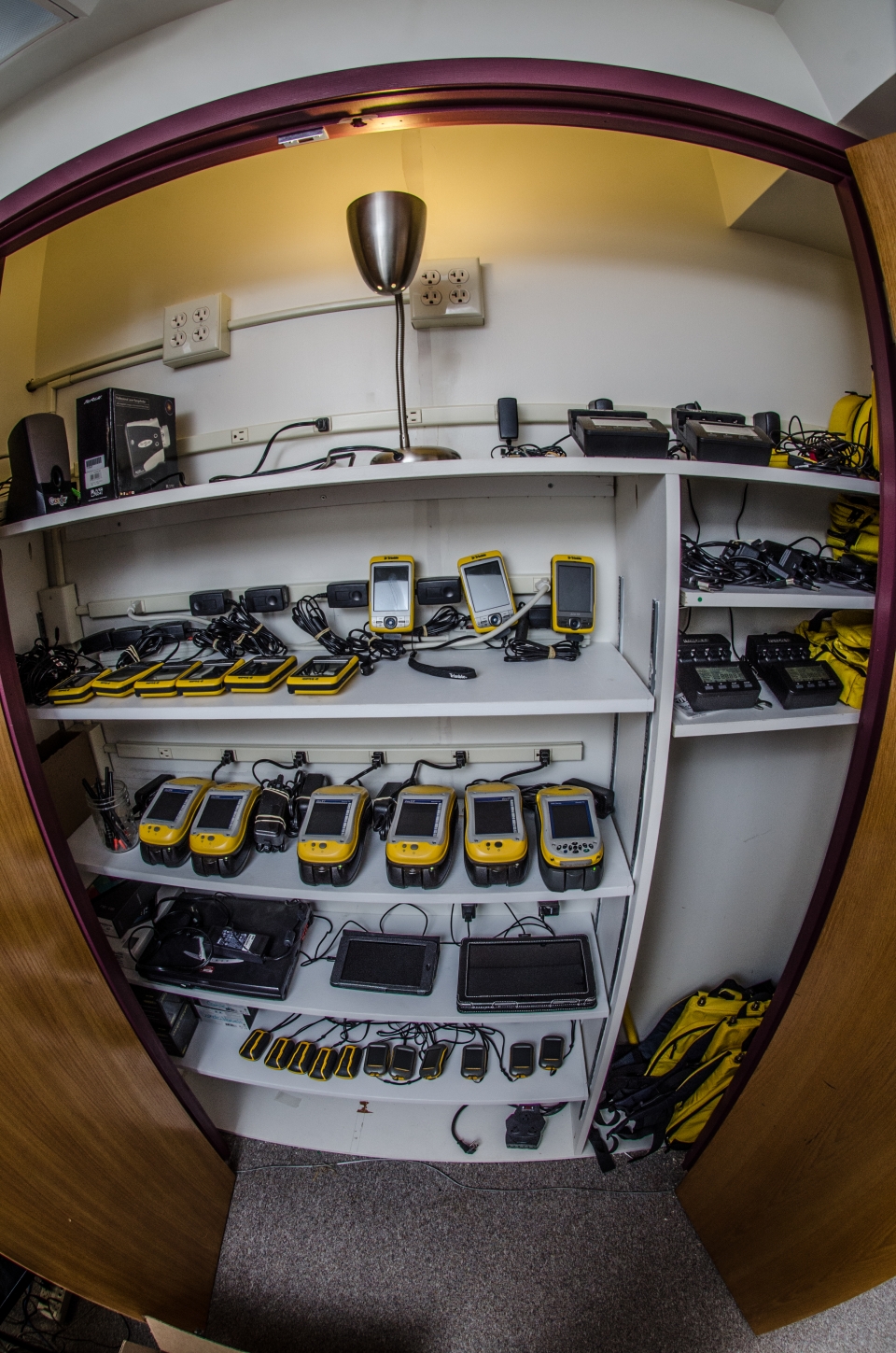
The Spatial Analysis Lab currently houses:
- 15 dedicated GIS workstations - HP Z1 Workstations and HP Compaq Elite 8300s
- 1 instructor station
- 1 medium format color printer - HP Officejet Pro K8600
- 1 large format color plotter - HP Designjet T1100ps
- 1 networked laser printer - HP LaserJet P3015
- 2 Tablets (Available for loan)
- 14 Trimble GPS units (XM, XT, XH, and Juno SB and 3Bs)
- 11 Garmin Dakota 10 GPS units
- GIS software including ESRI's ArcGIS 10.3.1 and Quantum GIS 2.6
- GPS Pathfinder Office (Trimble) and DNRGPS software
- Virtual Globe software includes Google Earth and WorldWind
Rules for working in the GIS Lab:
- The computers are for GIS WORK ONLY. Others will be asked to leave
- No food or drink at the workstations
- Save your work often and to a personal location (ex. “P” drive). Files are frequently erased from the hard drives
- After working, LOG OFF but DO NOT SHUT DOWN the computers
- Please report any problems to Carol Cady or the student technician on duty. Student technicians work during the semester Sunday thru Thursday evenings to help answer GIS related questions
Other Locations with GIS Software:
- Madill 222
- ODY Computer Labs